Mapping Connections
Mapping is a powerful tool for uncovering connections between people, place, and heritage.


/ answered
Mapping Connections: People, Place, and Heritage
Mapping is a powerful tool for uncovering connections between people, place, and heritage. The creation of heritage base maps highlights how these visual records serve as living reflections of stories, identities, and shared heritage. This collection of five maps offers unique insights into Sudan and the broader Sahel region, illustrating how geography shapes human experiences.
- People and Railways examines the link between population density and the railway infrastructure in Sudan. The design combines geographic, infrastructural, and demographic data to analyze human settlement patterns in relation to transportation infrastructure.
- People and Livelihoods illustrates the diverse livelihood patterns across Sudan, highlighting how different regions rely on various forms of agriculture, pastoralism, and mixed land use. The map also includes, administrative boundaries, and Sahel ecological zones, by visualizing these patterns, the map provides insight into how geography influences economic survival strategies in the region.
- Music and Festivals celebrates the rich cultural landscape of Sudan by mapping musical traditions and festivals across different regions. This visualization provides insight into Sudan's diverse musical expressions and communal celebrations, reflecting its deep-rooted traditions and regional identities.
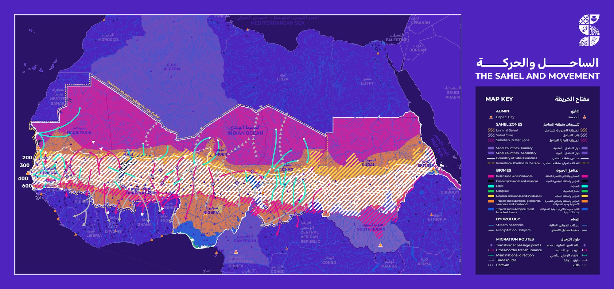
- The Sahel and Movement provides a detailed representation of migration patterns, biomes, and hydrology across the Sahel region of Africa. It highlights key Sahel zones, while also mapping transborder passage points, trade routes, and nomadic transhumance paths. The map incorporates biomes, such as deserts, savannas, and tropical forests, as well as stream networks and precipitation trends, demonstrating the environmental factors influencing movement. This visualization offers insight into how geography, climate, and human mobility interact in one of the most dynamic regions of Africa.
- People and the Nile illustrates the relationship between human settlements and the Nile River. It highlights populated areas, with a clear concentration of settlements along the Nile and its tributaries, emphasizing the river's crucial role in supporting life. The map also depicts hydrological features, including stream networks, and the Nile Basin, showcasing the interconnectedness of water systems and human habitation in this arid landscape.
Together, these maps provide a deeper understanding of the intricate relationships between geography, society, and heritage.

.svg)


